Aviation Safety & Security

Bird Strike Prevention Radar System
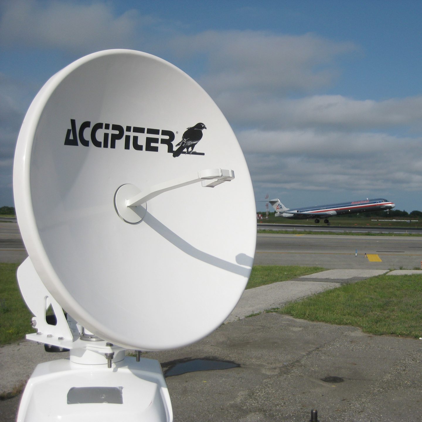
SKU: NM1-8A
The Accipiter® NM1-8A Avian Radar System is a software-definable, 2D surveillance radar specially designed to detect and track birds around airports. The system includes one radar sensor integrated into a NEMA-4 rated environmental enclosure, which houses the radar sensor electronics, digital radar processors, radar remote controller, radar data manager, power management and data communications components. The Radar System includes a high-resolution, X-band transceiver with 8’ array antenna that can be operated in either a horizontal or vertical orientation. An optional ground-tracking channel for surface movement, and aircraft tracking channel for aircraft movement are also available. The Accipiter® NM1-8A is well suited for use at civil and military airports.
Flexibility and Expandability
The Accipiter® NM1-8A Avian Radar System is built on Accipiter’s patented Radar Intelligence Network™ (RIN) platform technology which allows it to grow to meet your changing needs, flexibly and affordably. Additional sensors can be integrated, including radar sensors to expand coverage, as well as secondary sensors such as ADS-B, AIS, FOD sensors and cameras to increase awareness.

Volume Scanning 3D Avian Radar System
SKU: NM1-24D
The Accipiter® NM1-24D Avian Radar System is a software-programmable, 3D volume surveillance radar specially designed to detect and track small airborne targets of all types, including birds, drones and aircraft of all sizes. The system includes one radar sensor integrated into a NEMA-4 rated environmental enclosure, which houses the radar sensor electronics, digital radar processors, radar remote controller, radar data manager, power management and data communications components. Accipiter’s Total Coverage® 24D agile, X-band dish antenna is user programmable so that it can scan anywhere in the hemisphere. The Accipiter® NM1-24D is well suited for use at military and civil airports for bird strike risk mitigation, bird activity sampling for environmental assessments and general air domain awareness applications.
Flexibility and Expandability
The Accipiter® NM1-24D Avian Radar System is built on Accipiter’s patented Radar Intelligence Network™ (RIN) platform technology which allows it to grow to meet your changing needs, flexibly and affordably. Additional sensors can be integrated, including radar sensors to expand coverage, as well as secondary sensors such as ADS-B, AIS, cameras, weather sensors and FOD detection systems to increase awareness.
3D Avian Radar System
SKU: NM1-F24D
The Accipiter® NM1-F24D Avian Radar System is a 3D software-programmable, 3D surveillance radar specially designed to detect and track small airborne targets of all types, including birds, drones and aircraft of all sizes. The system includes one radar sensor integrated into a NEMA-4 rated environmental enclosure, which houses the radar sensor electronics, digital radar processors, radar remote controller, radar data manager, power management and data communications components. Accipiter’s manually-adjustable, X-band dish antenna can be set to any angle in elevation, allowing alignment to departure and arrival corridors, for example. The Accipiter® NM1-F24D is well suited for use at military and civil airports for bird strike risk mitigation, bird activity sampling for environmental assessments and general air domain awareness applications.
Flexibility and Expandability
The Accipiter® NM1-F24D Avian Radar System is built on Accipiter’s patented Radar Intelligence Network™ (RIN) platform technology which allows it to grow to meet your changing needs, flexibly and affordably. Additional sensors can be integrated, including radar sensors to expand coverage, as well as secondary sensors such as ADS-B, AIS, cameras, weather sensors and FOD detection systems to increase awareness.

Dual 3D Avian Radar System
SKU: NM2-24D/F24D
The Accipiter® NM2-24D/F24D Avian Radar System is a software-programmable, 3D volume surveillance radar specially designed to detect and track small airborne targets of all types, including birds, drones and aircraft of all sizes. The system includes two radar sensors integrated into a NEMA-4 rated environmental enclosure, which houses the radar sensor electronics, digital radar processors, radar remote controllers, radar data server, power management and data communications components. One sensor is configured with Accipiter’s F24D 24” dish antenna that is set to a user-selected, fixed beam elevation angle using a manually-adjustable thumbwheel. The other sensor incorporates Accipiter’s Total Coverage® 24D agile dish antenna that is user programmable so that it can scan anywhere in the hemisphere. The Accipiter® NM2-24D/F24D is well suited for use at military and civil airports for bird strike risk mitigation and air domain awareness applications.
Flexibility and Expandability
The Accipiter® NM2-24D/F24D Avian Radar System is built on Accipiter’s patented Radar Intelligence Network™ (RIN) platform technology which allows it to grow to meet your changing needs, flexibly and affordably. Additional sensors can be integrated, including radar sensors to expand coverage, as well as secondary sensors such as ADS-B, AIS, cameras, weather sensors and FOD detection systems to increase awareness.