Critical Infrastructure Protection

Homeland Security

Critical Infrastructure Protection Radar

SKU: NM1-8A

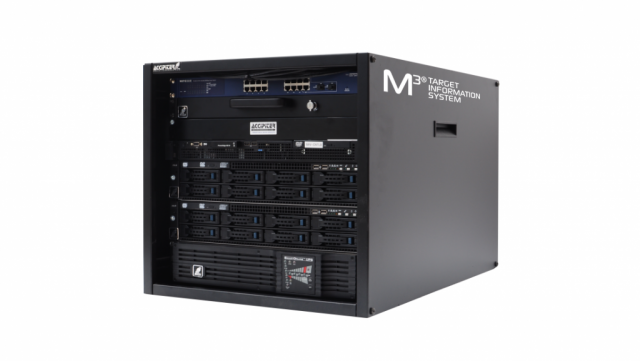
The Accipiter® NM1-8A Security Radar System is a software-definable surveillance radar specially designed to detect and track vessels from small pleasure craft to large lakers and salties, as well as low-flying aircraft of all sizes, including small ultralights, drones and general aviation aircraft. The system includes one radar sensor integrated into a NEMA-4 rated environmental enclosure, which houses the radar sensor electronics, digital radar processors, radar remote controller, radar data manager, power management and data communications components. The radar sensor is selectable from leading X-band and S-band manufacturers, including Furuno, JRC, Kelvin Hughes, Sperry Marine, and Terma, with antennas ranging from 4’ to 21’ in length.

The Accipiter® NM1-8A is well suited for critical infrastructure protection applications where surveillance of the water approaches and air approaches are critical for early warning of threats.

Flexibility and Expandability

The Accipiter® NM1-8A Security Radar System is built on Accipiter’s patented Radar Intelligence Network™ (RIN) platform technology which allows it to grow to meet your changing needs, flexibly and affordably. Additional sensors can be integrated, including radar sensors to expand coverage, as well as secondary sensors such as ADS-B, AIS, and cameras to increase awareness.

Critical Infrastructure Protection 2D Ku-Band GSR Radar System

SKU: NM1-T1002

The Accipiter® NM1-T1002 Security Radar System is a software-definable surveillance radar specially designed for detection and tracking of fast and slowly moving objects such as walkers, crawlers and small vehicles in and around high-sensitivity areas. The system includes one radar sensor integrated into a NEMA-4 rated environmental enclosure, which houses the radar sensor electronics, digital radar processors, radar remote controller, radar data manager, power management and data communications components. The Ku-band radar sensor is a Terma SCANTER 1002 ground surveillance radar.

The Accipiter® NM1-T1002 is well suited for critical infrastructure protection applications where early alerting of perimeter breach and tracking of intruders on the ground are critical to direct a response and mitigate threats.

Flexibility and Expandability

The Accipiter® NM1-T1002 Security Radar System is built on Accipiter’s patented Radar Intelligence Network™ (RIN) platform technology which allows it to grow to meet your changing needs, flexibly and affordably. Additional sensors can be integrated, including radar sensors to expand coverage, as well as secondary sensors such as ADS-B, AIS, and cameras to increase awareness.


Accipiter’s Radar Intelligence Network™ Platform Technology

Accipiter offers several carefully engineered systems to address your particular homeland security problems, and they are all built on our patented and game-changing Radar Intelligence Network™ (RIN) platform technology. The RIN architecture ensures your system can easily adapt and grow with your changing threats and needs.

Our novel approach to wide-area, real-time detection, tracking, post processing, and display coupled with on-the-fly and interactive analytics applied to historical target data sets us apart from any other radar systems provider, by giving you unprecedented situational understanding and decision support.

Our RIN allows any number of sensors to seamlessly connect over any TCP/IP network to our patented M3® Target Information System which forms the heart of all our delivered systems. And because the RIN was engineered to be radar agnostic, the right radar sensor(s) can be selected for your problem.

MTarget Information System (TIS)

Accipiter’s multi-sensor, multi-mission, multi-user M3® Target Information System (TIS) provides the ultimate in multi-sensor target data processing, query and retrieval, enabling rapid and efficient understanding that leads to strategic and tactical decision making. The TIS not only or­ganizes, stores indefinitely, fuses, manages and distributes the rich sensor target data in earth coordinates; but it also drives an ecosystem of user apps we call Surveillance-to-Intelligence™ (S2I) tools to deliver tactical and strategic information to users. Furthermore, the TIS integrates with a Device Activation Processor (DAP) that can be radar-activated to trigger camera geo-coordinate queuing and acoustic hailing in response to identified target scenarios. And real-time replication technology (RTRT) mirrors the TIS to other locations for partner information sharing, data redundancy and evidence protection.

The TIS also integrates with your third-party C2, dashboard and enterprise geographical information systems; and enables development of specific analysis and display tools by customers themselves. Any number of users can simultaneously operate their favorite S2I tools.

Surveillance-to-Intelligence ™ (S2I) Tools

Accipiter provides a suite of easy to use S2I tools, giving users with different roles or missions the situational understanding they need to be more effective at performing their duties. Tactical tools such as the Accipiter® Radar Common Operating Picture (COP) give watch standers and dispatchers a real-time map-view of target tracks from all sensors with built-in, 24-hour rapid replay along with alerts in response to detected threats of interest. Our tablet-based Mobile Response COP gives responders in vessels and vehicles a user-centric display, allowing them to more easily put their own eyes on live targets of interest so they can intercept.

Our strategic S2I tools interactively or on-the-fly rapidly mine the TIS’s historical target data to give intelligence analysts and managers understanding of target activity patterns and specialized reporting such as border crossing reports that allow them to better manage and allocate resources, as well as to plan operations to mitigate risk. The Accipiter® Track Histories Viewer delivers spatial patterns of tracks in your area of responsibility every hour, while the Accipiter® Target Analyzer Software (TAS) allows the analyst to generate a variety of temporal and spatial target activity distributions including heat maps, all filtered by time, date, size, speed, heading and altitude (where applicable).

Contact us for more information on our S2I tools and flexible approach to situational awareness possibilities.


Contact Us