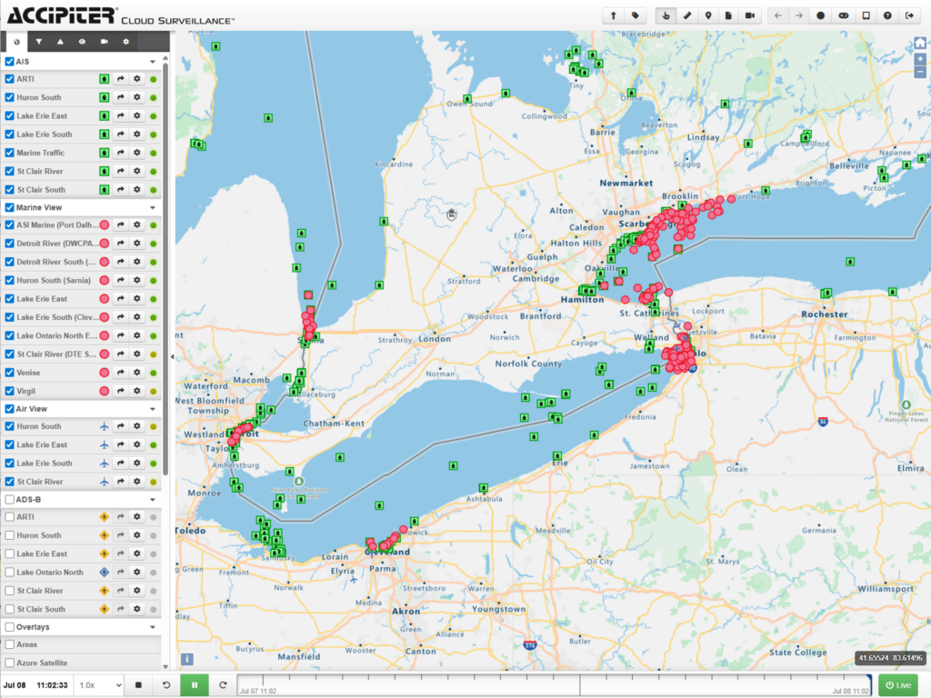
Browser-based to run on any device without plug-ins including government-issued computers
Real-time display of bird tracks, alerts to user-defined hazards, and mobile response tools to put “eyes” on the hazard
Dashboards to provide temporal/spatial bird activity patterns for hazard identification, risk assessment, and bird strike investigations
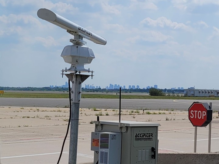
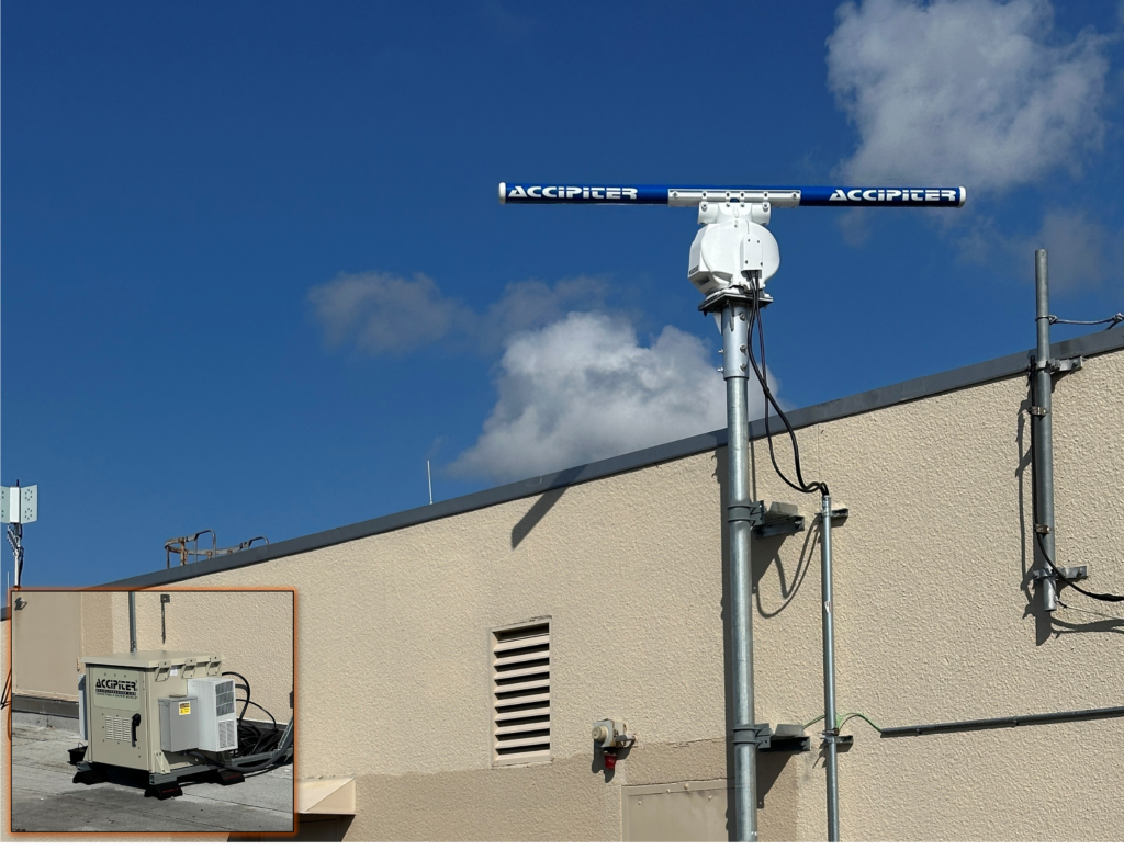
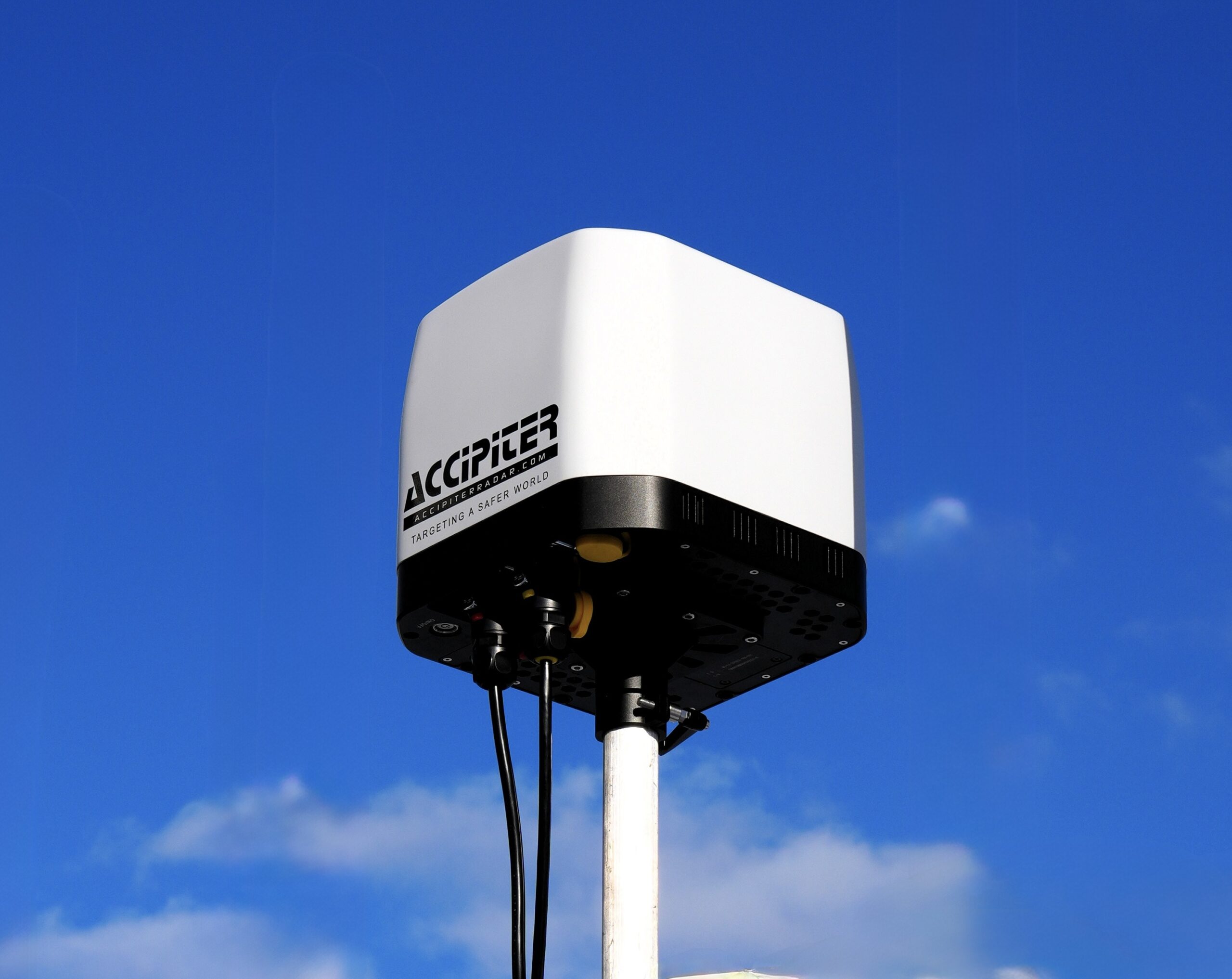
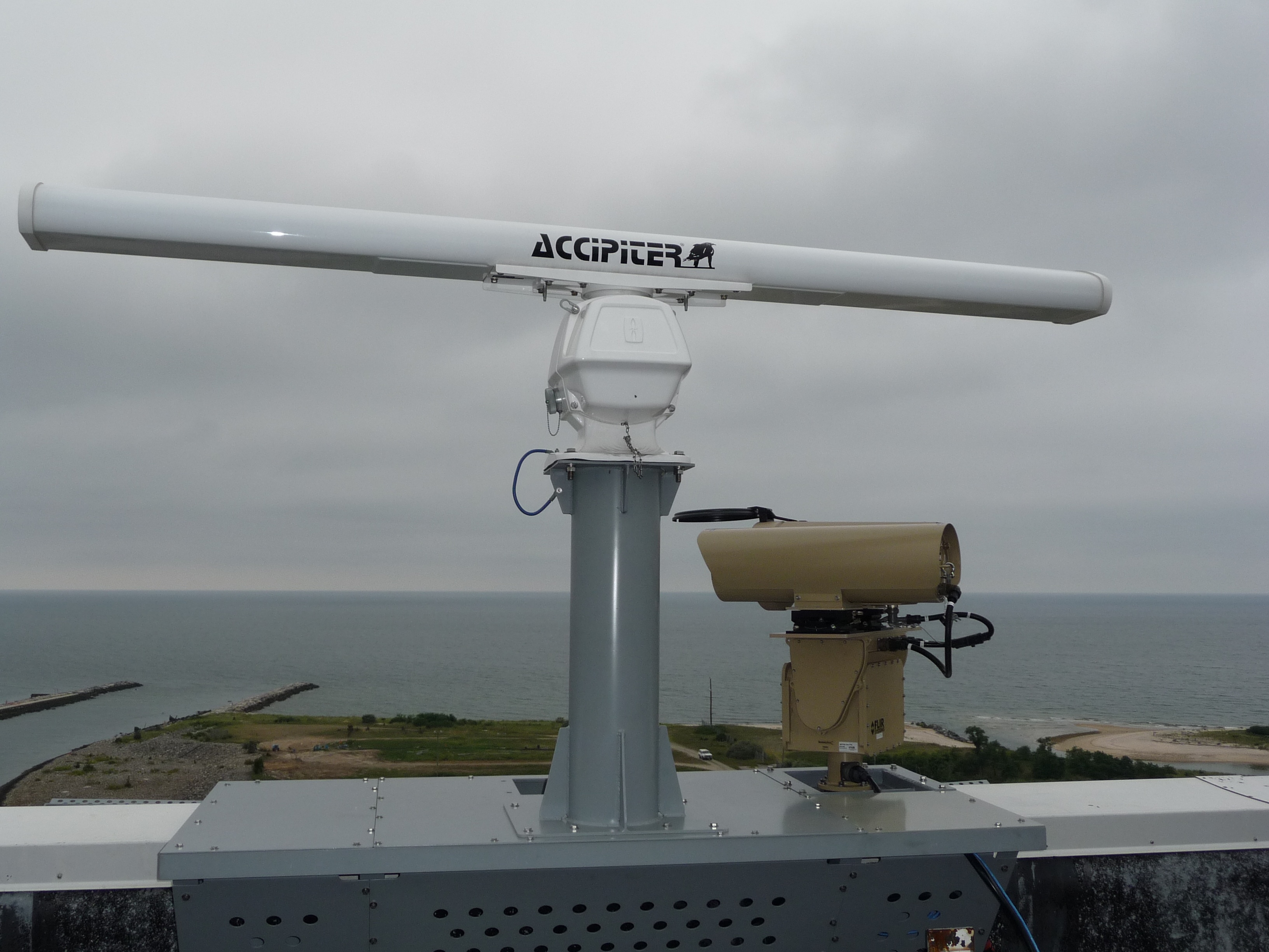
3D Avian Radars
Affordable surveillance provides 3D trajectories with latitude, longitude, altitude versus time for each tracked bird
Advanced digital radar processing, antenna and transceiver design provide excellent long-range performance on/off airport
Only our avian radar certified compliant with FAA Advisory Circular and DoD ESTCP and deployed globally
2D Avian Radars
Affordable surveillance provides 2D trajectories with latitude, longitude versus time for each tracked bird
Advanced digital radar processing, antenna and transceiver design provide excellent long-range performance on/off airport
Only our avian radar certified- compliant with FAA Advisory Circular and DoD ESTCP and deployed globally
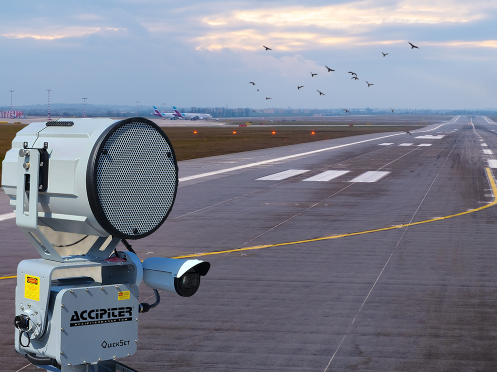
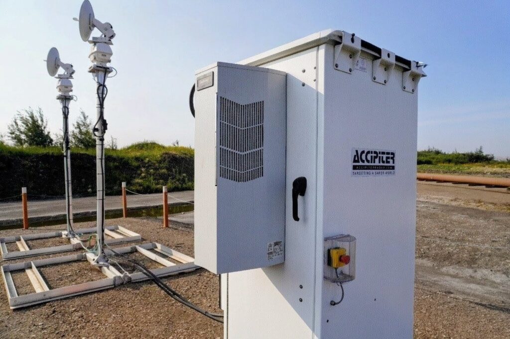
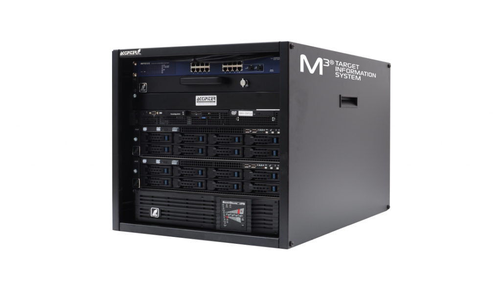
Optional Add-on Devices
The patented and integrated M3® Target Information System (TIS) provides flexible plug-and-play expandability to grow your system
Add radar-controlled/user-controlled deterrent devices and cameras to enhance bird-strike prevention capabilities
Expand surveillance coverage including for other threats such as drones
Accipiter® S2I Tools (All)
Browser-based to run on any device without plug-ins including government-issued computers
Real-time display of bird tracks, alerts to birds approaching or entering user/project-defined hazard areas
Dashboards to provide bird activity understanding for bird protection, deterrents management, reporting for regulatory compliance
Bird Radars for Environmental Monitoring
Affordable surveillance provides 3D trajectories with latitude, longitude, altitude versus time for each tracked bird
Advanced digital radar processing, antenna and transceiver design provide excellent long-range performance around (proposed) energy sites
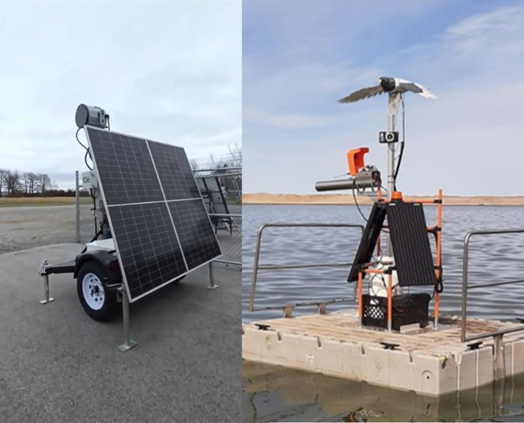
Mobile and solar-based off-grid solutions available for pre-construction monitoring
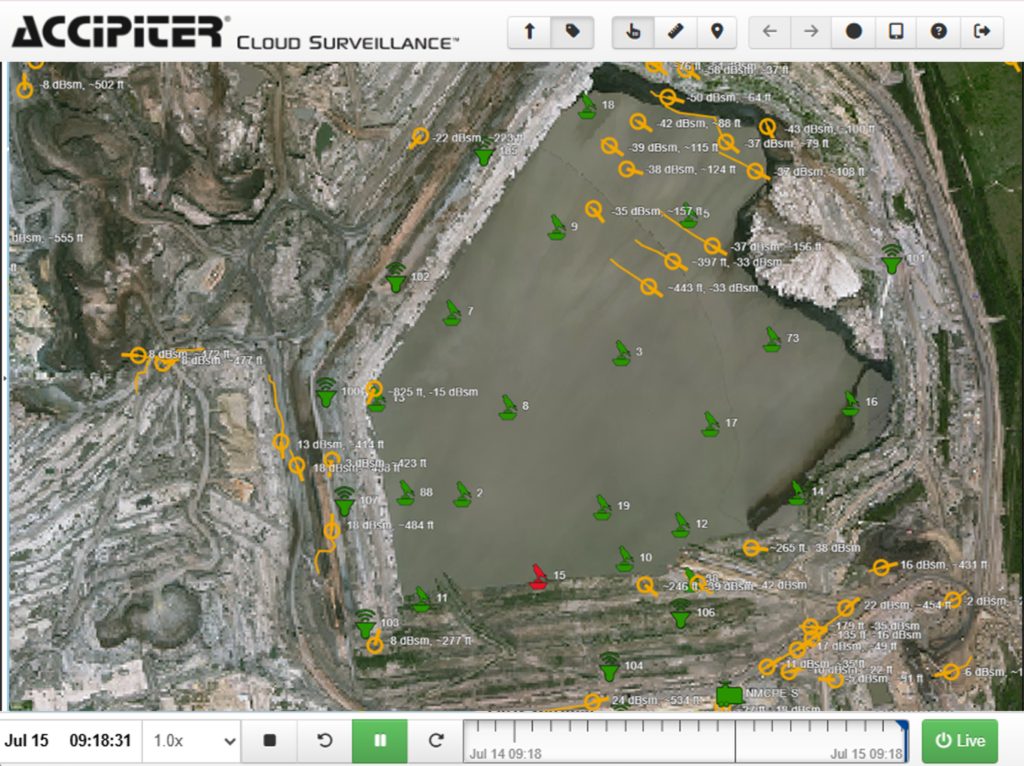
Radar-Activated Deterrent Systems (RADS)
Affordable surveillance provides 3D trajectories with latitude, longitude, altitude versus time for each tracked bird
Twin-radars at opposite ends of a tailings pond provides optimized coverage for birds approaching as well as flying over tailings ponds
Sophisticated processing alerts to birds on dangerous flight profiles and automatically triggers subsets of floating and/or land-based deterrents to deter birds without habituation
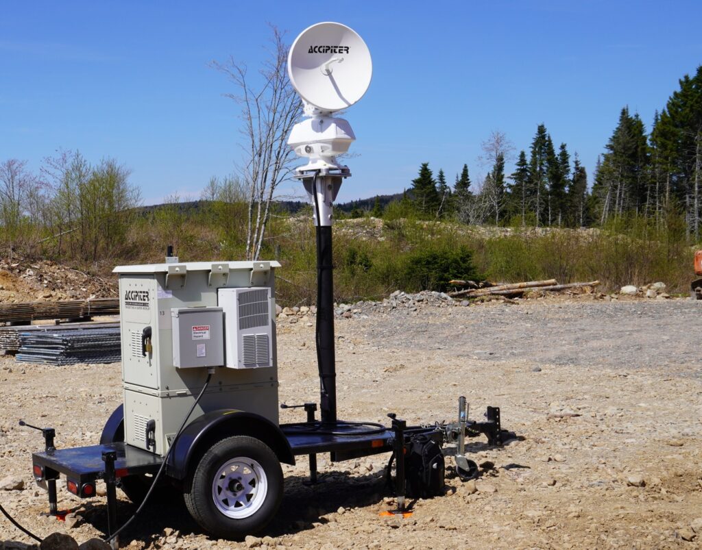
Deterrents Activated by RADS
Off-grid land-based, long-range acoustic deterrents provide first line of defence to persuade birds to alter course before reaching tailings pond
Off-grid floating deterrents provide second line of defence if birds are flying low-enough to land
Deterrent health monitoring and control are fully integrated into RADS over mesh networks providing critical information to tailings operators
Optional Add on Devices
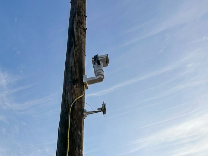
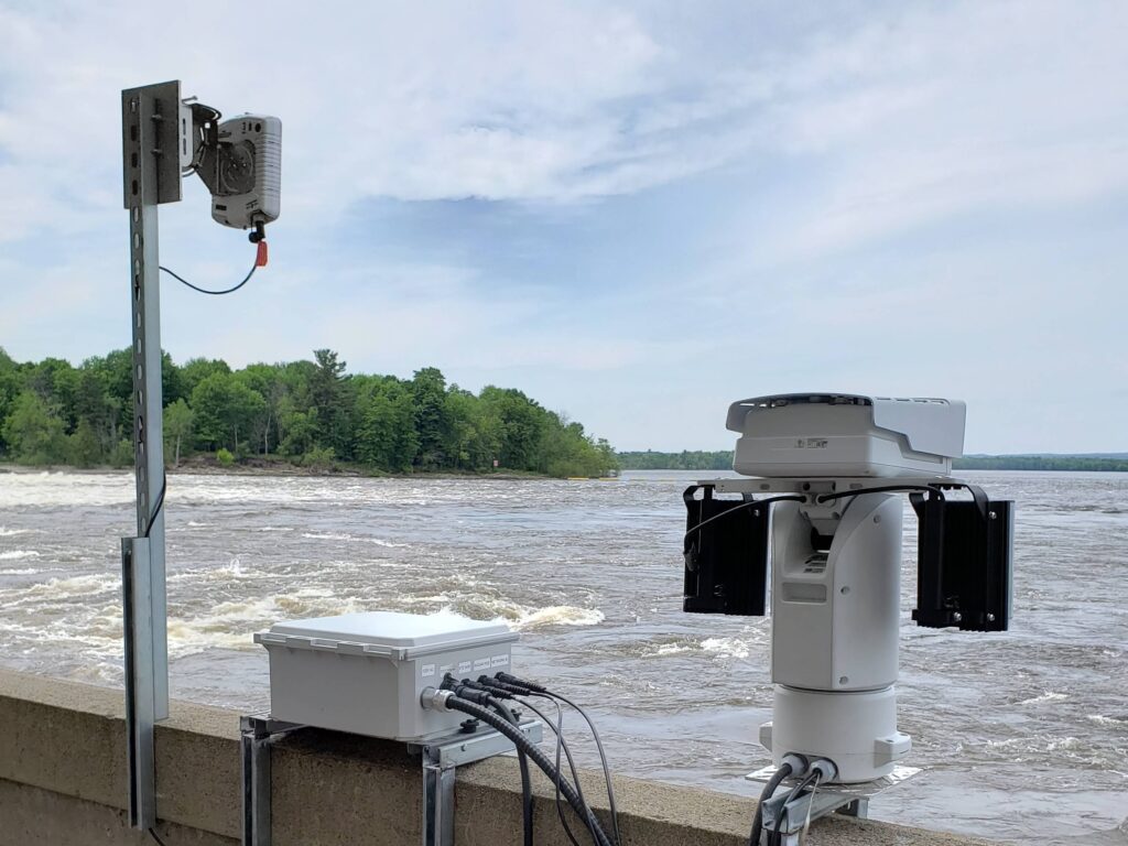
PTZ and thermal cameras can plug-and-play into RADS to provide valuable visual information day or night
Specialized short-range radars, drone detection, weather sensors and 3rd-party data sources can plug-and-play into integrated RADS
RADS can expand to cover entire region providing wide-area integration and regional information sharing and reporting
C-UAS
Accipiter® S2I Tools
Browser-based to run on government-issued computers and app-based to run on your phone
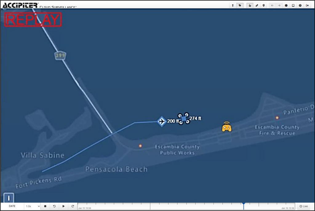
Real-time display of drone tracks & pilot locations for airspace awareness; and user-defined geo-fence alerts and airspace deconfliction alerts for response and mitigation
Dashboards to provide temporal/spatial drone & pilot activity patterns for hazard and suspicious activity identification, risk assessment, and investigations
Non Radar Surveillance Systems
Long-range Remote ID sensors for detection, tracking and identification of DJI and non-DJI compliant drones
Passive RF, library-based, sensors for detection, tracking and identification of DJI and non-DJI non-compliant drones which broadcast their telemetry
ADS-B receivers and data streams for detection, tracking and identification of cooperative, crewed aircraft
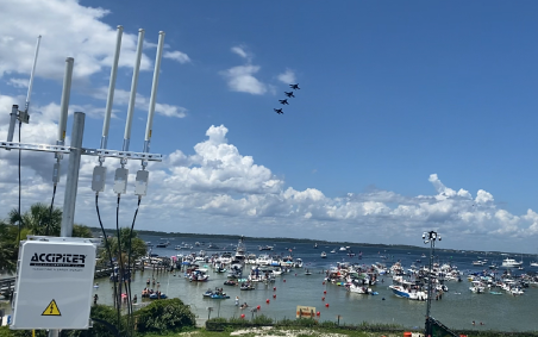
Radar Surveillance Systems
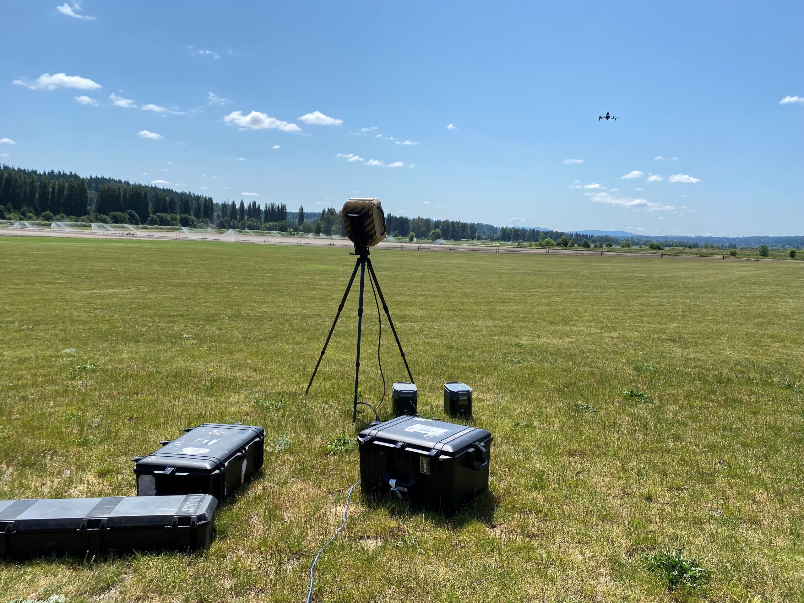
Mechanically rotating and fixed-panel, electronic-scanning 3D drone detection radars specially designed to detect dark, non-broadcasting drones, and all airborne targets
Automatic, real-time detection and tracking provide quality 3D trajectories with latitude, longitude, altitude versus time for each tracked drone
Advanced, on-board, time-frequency and AI processing helps classify drone targets from birds and other targets
Optional Add On devices
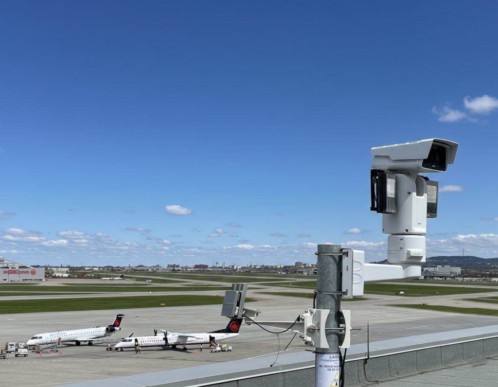
PTZ and thermal cameras can plug-and-play to automatically follow and “put eyes on” tracked targets for visual information day or night, including for assessment of a payload
Drone mitigation devices can be integrated to de-risk suspicious, nefarious and rogue drones
Accipiter’s M3® Target Information System (TIS) can enable information sharing and interoperability with your partners to jointly secure an event, critical infrastructure, or the airspace at large
BVLOS DAA
Accipiter® S2I Tools
Browser-based to run on any device without plug-ins including government-issued computers
Real-time awareness and display of crewed and uncrewed aircraft in your airspace with drone-specific, DAA (Detect and Avoid) alerts of intruder aircraft to enable beyond visual line of sight (BVLOS) operations
Dashboards to provide temporal/spatial aircraft activity patterns for risk assessment and strategic deconfliction.
Airspace Surveillance Systems
ADS-B and Remote ID sensors for airspace awareness of cooperative crewed aircraft and drones
2D and 3D short-range, medium range and long-range radar sensors for airspace awareness of non-cooperative (i.e. non-broadcasting) crewed aircraft
Ability to leverage existing surveillance sensors as they plug-and-play seamlessly with new ones
Fusion & Post Processing
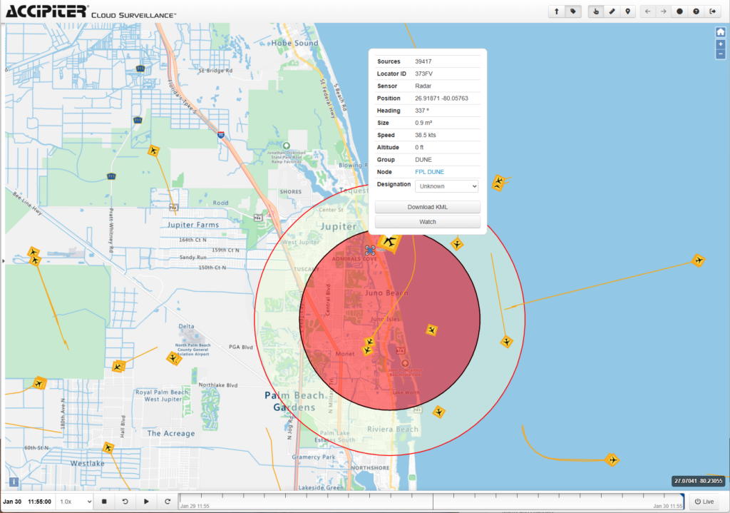
Real-time integrating and fusion of ADS-B and radar feeds enabling airspace awareness of both cooperative and non-cooperative aircraft
Real-time Data UNification Engine (DUNE) intelligently combines all aircraft data feeds into a simplified and unified feed reducing cognitive overload and increasing DAA efficacy
Advanced historical data analytics automate compliance monitoring and alerting, surveillance safety assurance, and support for your safety management system (SMS)
Optional Add On devices
Drone detection sensors can be added for awareness of non-compliant drones in your airspace
Accipiter’s M3® Target Information System (TIS) enables information sharing and interoperability with your partners to expand operations and airspace awareness
PTZ and thermal cameras can provide alerts to non-cooperative aircraft activity at specific locations in support of strategic deconfliction
MDA
Accipiter® S2I Tools
Browser-based to run on any device including government-issued computers and apps to run on your smart phone
Real-time awareness and display of non-cooperative and cooperative vessel tracks, alerts to user-specific situations of interest (SOIs), and mobile response tools for self-dispatch and efficient response to SOIs
Dashboards to provide temporal/spatial vessel activity patterns for identification of SOIs, risk assessment, search and rescue, and investigations of accidents and illegal activity
Radar Surveillance Systems
Mechanically rotating IMO and IALA radar sensors with advanced, real-time detection and tracking of all vessels from small pleasure craft to large ships
Fixed-panel, electronic-scanning radars filling coverage gaps and for use in narrow waterways
Integrated AIS receivers for real-time awareness of cooperative vessels
Fusion & Post Processing
Multi-radar fusion for radar networks covering larger ports, maritime borders and coasts
Real-time Data UNification Engine (DUNE) intelligently combines the surveillance sensor feeds into a simplified and unified feed reducing cognitive overload and increasing situational understanding
Integration with drone and low-flying aircraft sensors for all domain awareness
Optional Add On Devices
PTZ and thermal cameras of all types with automated radar slew-to-cue to “put eyes on” on SOIs
Drone detection and low-flying aircraft detection sensors
Accipiter’s M3® Target Information System (TIS) enables information sharing and interoperability with your partners to expand operations and obtain force multiplication through use of partner assets